6 Advantages of Using Aerial Robotics for Data Collection and Analysis
In this data-driven world, you need to have clear information about your surroundings to work on it. No matter which field you belong from, aerial robotics will help you collect precise data and make informed decisions.
Key Takeaways
- If you want to collect accurate data, in a fast and secure way, you have to use aerial imaging.
- It is cost effective as you will not need a large team of people collecting data in the field.
- You can see real-time images of an area you are surveying and share it instantly.
The world is highly data-driven today, and getting proper visuals is the best way to understand the surroundings. From agriculture, to infrastructure planning, to disaster response and infrastructure planning benefit from aerial data collection and analysis.
Initially, drones were all about pursuing hobbies and military requirements. As technology has advanced, improvements such as better sensor resolution, longer battery life, and lightweight materials have made it suitable for commercial applications.
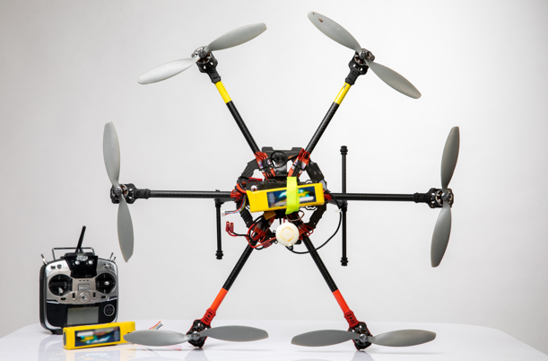
Aerial robotics has become a powerful solution for industries looking for safe, fast, and accurate means of collecting information. For instance, the DJI M400RTK has become a popular tool for collecting information.
What Are The Advantages Of Using Aerial Robotics For Data Collection?
there are various advantages of adopting aerial robotics for collecting accurate data. By using drones like MagDrone R3, organizations can collect effective data and improve on-site operations and enhance the accuracy of their insights and save money as well.
See also: Important Vaccinations and Visa Tips for Kenya Travelers
1. Unmatched Speed
One of the major advantages of using aerial robotics is its speed.Previously, this job used to take more than a week, but now with this technology you can gather data in just a few days or even within a few hours.
With UAV drone technology, it can fly over big landscapes and capture numerous images in just one day.After that, these images can be used to prepare 3D models and maps and begin analysis immediately.
2. More Accurate Results
You cannot compromise on accuracy when you are surveying. Even a small error, which seems insignificant, at the time can create a huge problem in land planning or construction. Drone surveying uses GPS technology and high-resolution cameras to gather data that are highly accurate.
Also, you can repeat the process multiple times with this process of survey and double-check the measurements. This way planners and engineers can be confident about the data they use.
3. Cost Effective
Using heavy equipment and a large team for a traditional survey is expensive. You will be paying for your travel, pay for the manpower and sometimes you even have to pay for the safety equipment.
Surveying and drone mapping reduce the cost by a large margin. When you work with a small team with an aerial robotic device, you cover more ground. This is advantageous for both small and large projects.
4. Can Access Difficult Areas
There are certain areas that are not easy to access. Areas with heavy traffic, steep hills and wetlands are difficult to survey. It can be risky to send people there physically.
With the help of UAV surveying, drones can fly over these risky areas and collect information without risking anyone’s life. This is one of the major reasons behind the popularity of drones in forestry, mining and environmental monitoring.
5. Real-Time Monitoring
Things change fast when you are managing big projects. While building a dam or a highway, you will need to track everyday progress.
With UAV drones like MagDrone R3 and their survey technology, you can capture real-time images and can share them with the team instantly. This helps you identify the issues early and you can solve it before they become major problems.
6. Collects Better Quality Data
Modern drones can also carry special cameras like thermal cameras and LiDAR sensors. These capture data in greater detail than traditional surveying methods.
With aerial robotic mapping, you get elevation models, contour lines and high-quality 3D and 2D maps that help organisations make informed decisions. This particular capability is extremely useful in disaster management, the agricultural industry, and city planning.
Which Industries Benefit Most From Aerial Imagery Techniques?
Aerial data collection supports multiple industries because of its versatility. Some of the important industries that it serves are:
- Infrastructure & Urban Planning: Aerial data collection helps in utilities, planning transport networks and urban layouts as it offers detailed elevation data and land information.
- Agriculture: Thermal and multispectral imaging allows farmers to identify irrigation needs, crop health and detect pest infestation before the situation worsens.
- Disaster Management: During forest fires, floods and earthquakes these high-quality images provide emergency teams with a clear overview of the affected area. This helps with relief operations and prioritising rescue efforts.
- Energy & Utilities: Aerial robotics images help monitor transmission lines, wind turbines and solar farms for vegetation encroachment, and reduces maintenance costs.
- Environmental Monitoring: Long-term aerial images and data support studies on coastline changes, biodiversity mapping and deforestation. It helps authorities take proper conservation measures.
What Is The Future Of Aerial Images?
With drones like the MagDrone R3, onboard processing and sensors are improving and the implementation of AI, aerial data and images are reshaping its utility.
In the future, the systems will depend on machine learning for predictive maintenance, automatic object detection and recognizing anomalies through live drone feeds.
In collaboration with 5G networks, you will be able to transform drone images immediately, manage traffic, conduct real-time surveillance and respond promptly during emergency operations.
Improve Your Services Today
There are various companies that are helping people in their respective fields with their amazing aerial robotics imaging. To stay ahead in this competitive market, you have to implement these technologies in your services. So, stay updated with the technological improvements.